Use cases
Get more out of it! LiDAR Scanner – (1) [What is LiDAR?]
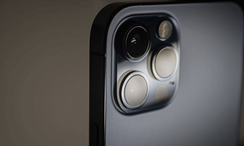
While developing and marketing the 3D scanner application “Sakura3D SCAN,” we thought it would be useful to suggest more ways to use LiDAR scanners and help our customers solve their problems, so here is a collection of articles about LiDAR.
First, what is LiDAR? Here is a brief explanation of what LiDAR is.
To begin with: What is LiDAR?
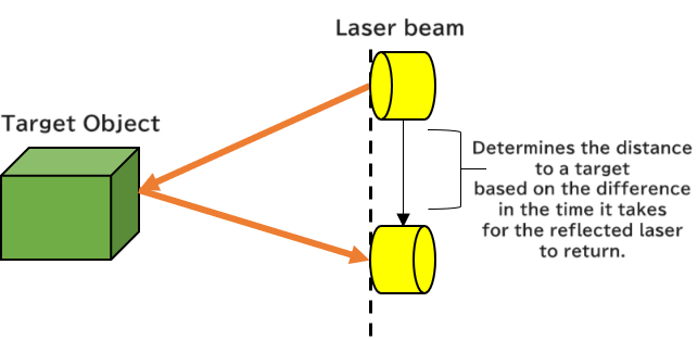
LiDAR is a remote sensing (non-contact measurement) technology that determines the shape and distance of an object by directing a laser beam at the object and measuring the waveform or the time it takes for the reflected light to return to the light source.
LiDAR is an acronym of “Light Detection and Ranging” or “Laser Imaging Detection and Ranging.” This technology is not new; it has been used since the 1960s, mainly in surveying, such as topographic surveys. In recent years, this technology has been researched, developed, and applied in a wide range of fields and is used not only in the field of surveying but also in familiar products around you.
Mechanism of LiDAR
The mechanism of LiDAR is incredibly simple. The distance or direction of an object is determined by directing a laser beam at the object and measuring the time it takes for the reflected light to return to the light source.
LiDAR is based on the same principle as radar (radio waves) but uses a laser beam with a higher density and shorter wavelength than radar and has the advantage of being able to accurately determine the shape of an object.
“What does it mean that a laser beam with a higher flux density and shorter wavelength provides high measurement accuracy?”
Laser beam flux is the amount of light emitted from a light source. In this case, it means the amount of laser power. Laser beam density is the laser beam flux per unit of solid angle. LiDAR uses a short-wavelength infrared laser beam to provide high range resolution,* which means high accuracy.
*Range resolution is the minimum distance at which two laser beams reflected from two objects in the same direction from the laser can be distinguished as two points.
The range resolution is expressed as follows:
Range resolution (△X) = nλ/2 (n = wavenumber, λ = wavelength)
LiDAR Development Status
LiDAR is currently being further developed by companies around the world. There are generally three types of LiDAR methods: mechanical scanning, solid-state scanning, and MEMS (microelectromechanical systems) scanning. Companies in the LiDAR industry have adopted one or more of these methods and are focusing on development and marketing in anticipation of the large market (field) described in the next section.
In which fields can LiDAR be applied?
Spatial Measurement
Aerial Laser Surveying
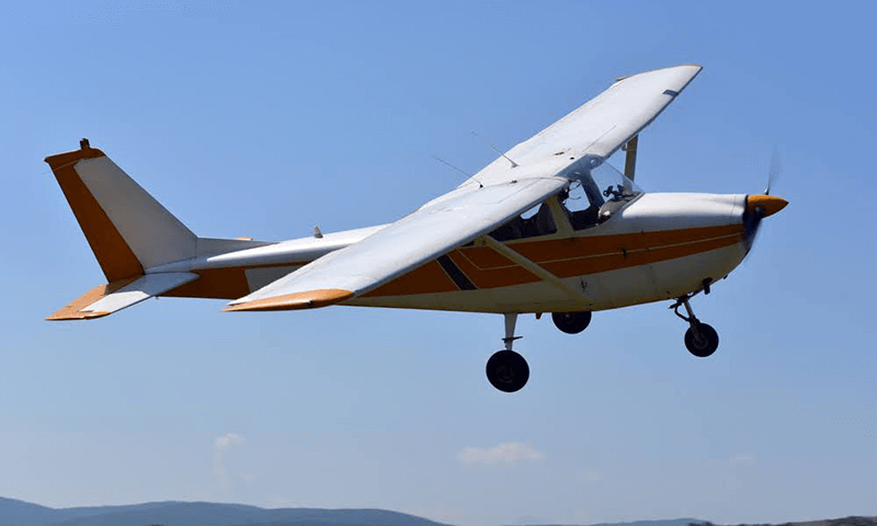
For aerial laser surveying, LiDAR systems are mounted on airplanes, helicopters, or UAVs (drones).
The coordinates of the ground surface are measured using a GNSS surveying instrument and an IMU (inertial measurement unit) that obtain accurate position information and analyze distance data. The topography is extracted and used from the scanned data.
Some types of LiDAR systems simultaneously collect elevation and water depth data. This system is used to extract the topography of the bottom of water bodies such as shorelines, harbors, and rivers.
Surveying with a combination of three instruments: LiDAR system, GNSS surveying instrument, and IMU!
“Why does aerial laser surveying need to determine the position, attitude, and acceleration of an aircraft in addition to measuring distances using the reflection of laser beams?”
A LiDAR system is mounted on an aircraft. Even when it is mounted on the underside of an aircraft, the laser beam is not always perpendicular to the ground due to the tilt of the aircraft. To ensure an accurate survey in such a situation, it is necessary to know the aircraft’s position, attitude (orientation), and acceleration.
GNSS instruments determine the aircraft’s position, while IMUs determine the aircraft’s attitude and acceleration.
The exact position and attitude of the aircraft are determined by taking the above into account, and the coordinates determined by the laser beams are corrected.
Land Laser Surveying
There are two types of land laser surveying: ground-based (fixed), which uses an instrument installed on the ground, and vehicle-based (on-board), which uses an instrument installed on a moving body, such as a car.
| Fixed type | In-vehicle type | |
|---|---|---|
| Installation location | Surface of Surveying Area EX: Inside and outside a facility | Moving body EX: Cars, Trains, or Ships |
| Target | 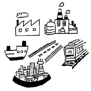 | 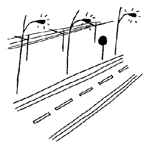 |
Fixed-type laser surveying is a measurement technique where the LiDAR system is fixed to the ground to be surveyed. In many cases, instruments are installed inside and outside a facility and collect high-resolution, high-density point clouds. These high-resolution, high-density point clouds are used to repair and manage large facilities such as factories, plants, and shipyards, as well as various facility equipment, to inspect infrastructure such as roads and railways, or to create urban models.
Onboard laser surveying collects the point clouds from a LiDAR system mounted on a moving body. In addition to cars, a LiDAR system can also be mounted on trains or ships (boats). The scanned data is used to identify and utilize road features such as road signs, streetlights, and overhead power lines.
Autonomous driving

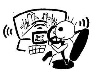
The autonomous vehicle industry is one of the areas where LiDAR detection technology is being explored. Autonomous driving requires constant awareness of the ever-changing surrounding environment. Therefore, LiDAR detection technology is expected to play the role of human eyes.
・Current road conditions
・Determining the distance between cars
・Detecting pedestrians, cars, and other obstacles
In addition to the above, a large amount of constantly changing information must be processed without fail and at high speed.
The level of autonomous driving is clearly defined.
Currently, cars with an autonomous driving level of three or higher can be called self-driving cars.
For such cars, it is essential to be aware of the surrounding environment as mentioned above. To achieve this, using LiDAR technology in combination with various detection technologies may be effective.
Society of Automotive Engineers of Japan, Inc.
“JASO Technical Paper: Taxonomy and Definitions for Terms Related to Driving Automation Systems for On-Road Motor Vehicles”
Excerpted from “Table 1 – Level Definition of Vehicle Driving Automation.”
Level 0: No Driving Automation

The driver performs all dynamic driving tasks.
Level 1: Driver Assistance

The driving automation system performs vehicle motion control subtasks in either the longitudinal or lateral direction of the dynamic driving task in a specific limited area on a sustained basis.
Level 2: Partial Driving Automation
The driver automation system performs both longitudinal and lateral vehicle motion control subtasks of the dynamic driving task in a specific limited area on a sustained basis.
Level 3: Conditional Driving Automation

The driver automation system performs all dynamic driving tasks in a limited area on a sustained basis.
Users are expected to be ready to respond in the event of any difficulty in continuing vehicle operation.
Level 4: High Driving Automation

The driver automation system performs all dynamic driving tasks and responds in the event of any difficulty in continuing vehicle operation in a limited area on a sustained basis. In the event that continuing vehicle operation is difficult, users are not expected to respond to a request to intervene.
Level 5: Full Driving Automation

The driver automation system performs all dynamic driving tasks and responds to any difficulty in continuing vehicle operation on an unlimited and sustained basis. In the event that continuing vehicle operation is difficult, users are not expected to respond to a request to intervene.
Application to Smartphones
The most familiar example of LiDAR technology is probably smartphone cameras.
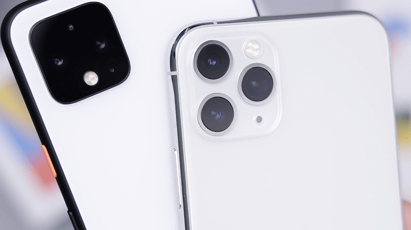
On October 14, 2020, Apple announced that the iPhone 12 Pro and iPhone 12 Pro Max included a LiDAR scanner.
By incorporating LiDAR, these iPhone models are expected to be used in AR (augmented reality). AR has a problem with occlusion, where images superimposed on real objects appear in front of or behind them. LiDAR can solve this problem by quickly scanning the position information of the surrounding area.
Using LiDAR on the iPhone and “ARKit,” an Apple AR framework for developers, makes it easy to develop AR applications using the iPhone/iPad. ARKit also makes it easy to collect the point clouds obtained by LiDAR and is expected to be adopted in various fields.
In photography, which is a basic function of smartphones, an article reported that LiDAR helps improve the autofocus speed due to its advantage of not being affected by darkness (because it uses laser beams).
LiDAR is now familiar and readily available, as smartphones like the iPhone 12 Pro and the iPad Pro have adopted it. While autonomous driving is expected to bring new business opportunities, it is also becoming a technology used by the general public. Would you like to experience this easy-to-try technology for yourself?
The next article provides helpful tips for using LiDAR scanner applications on your smartphone to obtain “usable” point clouds as accurately as possible.
February 8, 2022
tag : LiDAR Sakura3D SCAN
